
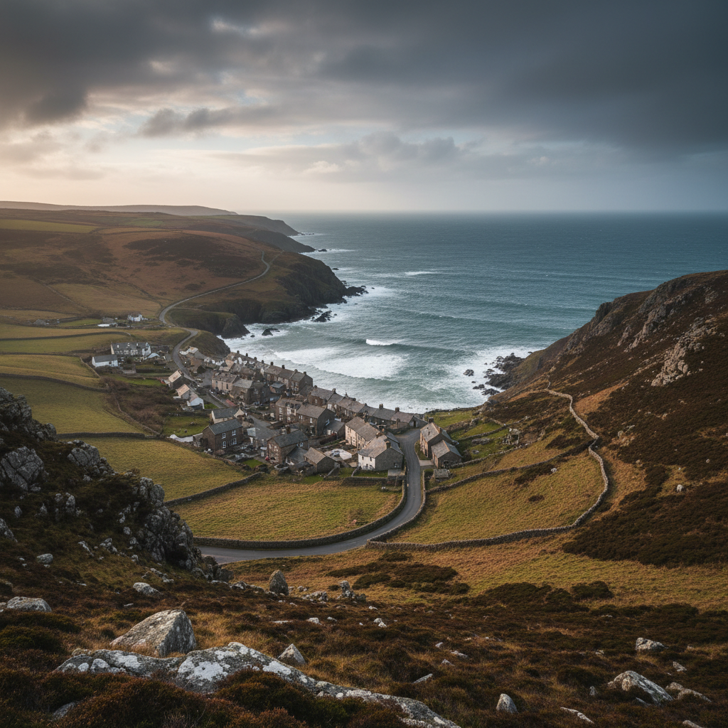
Exmoor · North Devon coast
Hartland
A remote-feeling village close to some of the South West’s wildest coastline.
About
Hartland
Hartland sits near the north-western tip of Devon, close enough to the Atlantic to feel its presence on most days. The village itself is modest in scale, arranged around a square that doubles as a car park and gathering point, with a handful of shops, a pub, and the kinds of buildings that suggest slow accumulation rather than deliberate planning. It is not a destination in the conventional sense. It does not trade heavily on itself. What brings people here, more often than not, is what lies beyond it.
The coastline west of Hartland is among the most geologically dramatic in southern England. The cliffs at Hartland Point and Hartland Quay drop sharply to wave-cut platforms of contorted rock, folded and fractured by ancient pressures into formations that seem almost deliberate in their complexity. The sea here is rarely calm. Even on still days, a swell runs against the base of the cliffs, and the sound carries some distance inland. This is a stretch of coast with a long and unsparing relationship with shipwrecks, and the landscape holds that history without sentimentalising it.
The village lies roughly a mile and a half from the sea, far enough to feel genuinely inland when the wind drops, close enough that the Atlantic atmosphere is never entirely absent. The hinterland is a patchwork of deep Devon lanes, small farms, and wooded combes running down towards the coast. Hedgerows grow tall and dense on either side of most roads, making navigation feel more intimate than the map suggests.
People come here primarily to walk the coast path, to photograph the rock formations and crashing water, and to feel the particular quality of remoteness this corner of Devon offers. There is no resort infrastructure, no amusement or organised leisure. What Hartland provides is access to landscape, and for those who want little else, that is considerable.
Character
The feel of Hartland
The village has the slightly self-contained feel of a settlement that has never had much reason to look outward. The square is functional rather than picturesque: a post office, a pub, some stone buildings that hold their own without being remarkable. There is a church nearby, St Nectan's, which is large enough to suggest this was once a place of greater importance, its tower visible from some distance across the surrounding fields. The scale of the building relative to the village is notable, a reminder that communities shift and contract across centuries without always leaving an obvious trace.
What you notice, spending a little time here, is that Hartland has a local rhythm that is not adjusted for visitors. People move through the square on their own business. The pub serves the people who live within reach of it as much as those passing through. There is no particular performance of welcome, but neither is there indifference. It is the quality of a place that has not needed to reinvent itself and therefore has not had to. The community here is small, agricultural in its roots, and shaped by the physical difficulty of the surrounding landscape as much as by any administrative boundary.
That sense of local character runs through the small details: the notices on boards that refer to events and people most visitors will not know, the way the lanes around the village are used by working vehicles as well as walkers, the absence of the kind of soft heritage that tends to accumulate in better-known Devonian villages. Hartland does not curate its identity. It simply continues.
Map & Getting Here
Getting to Hartland
What to expect
A natural way to spend time here
The approach to Hartland along the B3248 is gradual, the road narrowing incrementally as the village draws closer. You pass through a landscape that feels less travelled than much of Devon, the hedgerows higher, the verges less managed, the occasional farm building sitting close to the road without apparent concern for passing traffic. The village announces itself quietly, the square appearing before you have quite expected it.
On most days, wind is a presence here in a way it is not further inland. Even within the village, sheltered by walls and buildings, there is often a trace of it, and on the coast path it can be the dominant condition rather than a background detail. The smell of the sea arrives before the cliffs are visible, salt and something mineral from the exposed rock. In wet weather the lanes leading west become streaked with mud from the fields, and the path surface changes from firm turf to something considerably less reliable underfoot.
The place rewards patience more than activity. Those who arrive with a single objective, a particular viewpoint or a specific stretch of coast path, tend to get less from it than those willing to lose time in the lanes, to stop where a gate opens onto a view, to sit on the cliff edge without any particular plan. There is a quality of attentiveness that Hartland asks of its visitors, and it returns the favour in proportion.
What makes it stand out
What makes Hartland special
What distinguishes Hartland from other north Devon villages is not any single feature but a combination of factors that together produce a quality of genuine isolation. Clovelly, fifteen miles to the east, has long been managed for visitors. Boscastle and Tintagel, across the county border, carry their own freight of expectation. Hartland carries very little of that. The infrastructure for tourism is thin by comparison, and the village makes no particular effort to compensate. For some visitors that is a disadvantage. For others it is the point.
The coastline itself is specific in ways that photographs do not always fully convey. The rock strata at Hartland Quay and along the path towards Speke's Mill Mouth are near-vertical in places, the result of folding so extreme that beds which were once horizontal now run almost perpendicular to the cliff face. It is the kind of geology that rewards attention rather than a quick look, and the wave platforms at the base of the cliffs, exposed at lower tides, give an unusual sense of being close to the structure of the landscape rather than simply observing it from above.
Don't miss
Things to see and do
Walk west from the village to Hartland Point and stand at the lighthouse level to watch the sea conditions change across a single hour.
Follow the coast path south from Hartland Quay to Speke's Mill Mouth, where a stream drops directly onto the beach over a short waterfall.
Look down from the cliff path at the wave-cut platforms to read the geology in the rock layers, which are among the most dramatically folded on this coastline.
Visit St Nectan's Church in Stoke, just north of the village, and take time to understand its scale relative to the settlement that supports it.
Time a visit to Hartland Quay for a low tide and walk the exposed platform at the base of the cliffs, where the folded strata are closest.
Photograph the rock formations in the hour before the light goes flat, when angled light picks out the texture and layering of the cliff face.
Walk one of the deep Devon lanes east of the village early in the morning, when the hedgerow birds are loudest and the road is briefly empty.
Walks from here
Getting out from Hartland
The most direct walking route from the village heads west along lanes to Hartland Quay, roughly two miles, following signs through Stoke and then descending a narrow road to the small cluster of buildings at the water's edge. From there the South West Coast Path runs both north towards Hartland Point (about two miles, with significant ascent and descent along the way) and south towards Speke's Mill Mouth and Elmscott. The southern stretch is considered by many who know this coast to be among the finest walking in north Devon: exposed, technically straightforward but physically demanding, with very few other walkers outside summer weekends.
Circular routes from the village are possible using the network of inland lanes and bridleways, though the footpath signage in this area can be inconsistent and an OS map or reliable GPS is useful rather than optional. A reasonable circuit of eight to ten miles takes in the coast at Hartland Quay, a section of the cliff path in either direction, and returns inland through the lanes via Stoke. The terrain between the coast and the village involves repeated descent and re-ascent through steep combes, which should be factored into time estimates.
Good to know
Before you go
The road to Hartland Quay is single-track for much of its length and can become congested on busy summer days, particularly in August. Arriving early or later in the afternoon avoids most of the difficulty. The car park at the Quay is small and fills quickly on fine weekends. Parking in the village and walking to the coast is a reasonable alternative and adds relatively little distance.
Mobile signal in much of this area is unreliable, and the lanes between the village and the coast are not well served by signage. Downloading the relevant OS map section offline before visiting is practical advice rather than a precaution. The coast path in this area involves sustained undulation and some exposed sections close to cliff edges, which should be treated with appropriate care in wet or windy conditions, both of which are common.
Across the seasons: Hartland in high summer is busier than its scale comfortably absorbs, though even in August the coast path beyond Hartland Quay rarely feels crowded for long. The light in June and July stays long enough for evening walks to the cliff edge, and the exposed position means sunsets here can be dramatic without being predictable. The wildflowers on the cliff top are at their fullest in late May and June, sea campion and thrift colouring the turf above the rock. Autumn brings a perceptible shift. By October the lanes are quieter, the light lower and more directional, and the sea noticeably more active. This is arguably the best season for photography along this stretch of coast: the colours in the surrounding farmland change slowly from green to ochre, the tourist infrastructure contracts, and the fundamental character of the place becomes more legible without the distraction of seasonal activity. November and through the winter months can be severe, with the coast path genuinely difficult in high winds and the lanes around the village prone to flooding in prolonged wet spells. Those who visit in winter tend to do so with clear intentions and appropriate preparation, and they often describe it as the most rewarding time to be here.
Practical info
Practical info
Hartland village has limited parking, centred mainly around the small public car park near the village square. Spaces fill quickly in summer, particularly on weekends when visitors use the village as a base for the coast path. Street parking exists but is narrow and shared with residents, so arriving early is sensible. There is a separate car park at Hartland Quay, a few miles further west, which serves those heading directly to the cliffs.
The village has a pub, a small shop, and a post office, though opening hours can be reduced outside the summer season. Public toilets are available in the village, though their reliability out of season is not guaranteed. Hartland Quay has its own small hotel and bar, which is useful if you are spending time on the coast. Do not expect the range of facilities found in larger North Devon towns.
The village itself is easy to walk around, but the terrain changes significantly once you head towards the coast. The cliffs at Hartland Point and Speke's Mill Mouth involve steep, uneven paths that become slippery after rain, and stout footwear is strongly advised. The exposure to Atlantic weather means conditions can shift quickly, and the coastal paths here are more demanding than their distances suggest. Those walking from the village to the coast should allow more time than the mileage implies.
varies
Join the 3moors Community for path conditions & local tips.
JoinWhy this place matters
Hartland — in its own right
What Hartland offers is not comfort or ease but something less common: the experience of a place that has not been smoothed into legibility for the visitor. The seasonal rhythm here is an agricultural one rather than a tourism one, and that distinction matters. The village quietens and closes in autumn not because the experience is over but because the year has moved on in the way it always does, and life here follows that movement rather than resisting it. There is a continuity to Hartland that outlasts any individual visit. The lanes and the fields and the cliff path exist in a relationship with each other and with the people who live within reach of them that is older and more durable than anything a visitor can quite access. What you take away from a day or two here is less a set of experiences than a sense of having briefly occupied the edge of something larger and more persistent than yourself. That is not nothing. For some people it is exactly what they came for.