
Exmoor · West Somerset coast
Minehead
The traditional starting point for the South West Coast Path and a practical Exmoor gateway.
About
Minehead
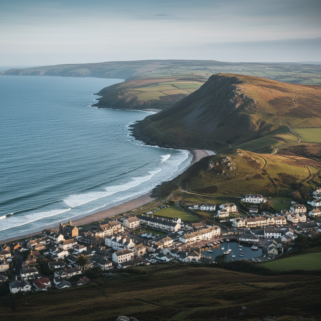
Minehead sits at the northern edge of Exmoor where the moor tips abruptly into the Bristol Channel, the hills behind the town rising steeply enough that you can be on open moorland within thirty minutes of leaving the seafront. It is a proper Somerset resort town, with all the practical apparatus that implies: a broad beach, a working harbour, amusements, a high street of the familiar coastal kind. But the setting gives it a character that outlasts the seasonal trappings.
The quality of light here is particular to this stretch of coast. The Bristol Channel is not the open Atlantic
it is wide enough to carry a horizon but constrained enough that the light reflects and refracts in layered ways, especially in the hours either side of midday when the water takes on a pewter-silver quality that shifts with the tide. In summer, with the sun high and the channel calm, there is an almost glassy stillness on the water. In winter or under cloud, the surface turns a deeper slate, the Welsh coast just visible across the water as a low grey line. You notice the light before almost anything else.
Minehead is most widely known as the official starting point of the South West Coast Path, a designation that gives the town a particular kind of purpose. The stone marker on the seafront is photographed by walkers beginning a journey of nearly a thousand miles around the peninsula. For most visitors, the destination is rather shorter than that, but the same impulse applies: the coast path west of town climbs steeply almost immediately, and the transition from seaside to something more elemental happens with remarkable speed.
Character
The feel of Minehead
The western end of Minehead, around the harbour and the older part of town known as Quay Street and Blenheim Road, has a different character from the main seafront. The buildings are lower and closer-set here, the streets narrowing as they climb towards North Hill, and there is a sense of the town having grown outward from this older core rather than been imposed on the landscape from above. The church of St Michael sits high above the harbour on a wooded hillside, visible from the beach as a point of orientation.
What distinguishes the coastal character of Minehead from softer resorts further along the Somerset coast is the exposure. The town faces north across the channel, and even on still days there is a quality to the air here that reminds you the Bristol Channel is a tidal body with considerable fetch to the west. The wind, when it comes, arrives without obstruction. The beach at the western end, near the harbour wall, is made up of coarser sand and some shingle, and at low tide the flats extend a considerable distance, leaving a landscape that feels more open and stripped-back than the sheltered coves you find elsewhere on this coast. This exposure is not a flaw
it is what keeps the place honest.
North Hill, the wooded promontory that forms the western boundary of the town, absorbs some of the prevailing weather and creates a microclimate of sorts, but once you are above the tree line on its upper slopes, the full scale of the channel opens out and the exposure becomes something to lean into rather than shelter from. It is this combination of accessible town and genuinely open coast that gives Minehead its particular atmosphere.
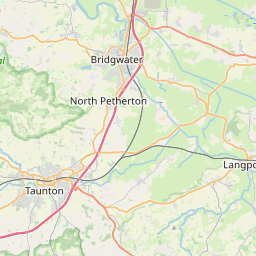
Map & Getting Here
Getting to Minehead


What to expect
A natural way to spend time here
The beach path from the town centre runs along the seafront past the coast path marker and then curves towards the harbour, with North Hill rising on the left and the channel broad and flat ahead. The surface underfoot changes as you move west: tarmac gives way to packed sand and then to shingle near the old harbour wall, and you begin to notice the texture of the place more acutely when the smooth going ends. There are groynes at intervals along the beach, and at low tide the uncovered sand stretches far out, crossed by shallow runnels of tidal water.
At the water's edge in quieter months, oystercatchers work the exposed flats with a kind of businesslike precision, their calls carrying clearly above the low surf. Redshank are present in autumn and winter, probing along the tideline, and the exposed channel mudflats to the east, accessible from the beach at low tide, draw waders in numbers that reward a patient hour with binoculars. The Bristol Channel is one of the major flyways on this coast, and what passes overhead on a clear October morning can be quietly surprising.
The most rewarding approach to Minehead as a coastal place is to arrive before the day organises itself, to walk the beach at low tide and then climb even a little way up onto North Hill before returning. The change in perspective from sea-level to even a modest height above the town reveals how the place is arranged, how the hills behind contain it, and how the channel extends westward into what feels like open distance.
What makes it stand out
What makes Minehead special
What separates Minehead from the other small coastal towns along this stretch of Somerset is the immediacy of the transition from settlement to landscape. Within a short walk from the seafront, the coast path begins its long climb onto the flanks of North Hill and the open moor beyond. There is no gradual thinning out of the town into the country, no ribbon of development softening the edge. The town simply stops and the moorland begins. This is partly a consequence of geography: the hills rise too steeply to have been built on, and Exmoor National Park boundary runs close to the edge of the settled area. But the effect is that Minehead functions as a genuine threshold, a place from which you step into something quite different.
The town is also the only settlement of any size on this stretch of the Somerset coast that offers the full range of services a walker or family visitor needs without having become predominantly tourist in its identity. It has a working high street, a GP surgery, a secondary school, a steam railway terminus. These are not glamorous distinctions, but they mean the town retains a year-round life that many comparably sized coastal places have lost. Visiting outside peak season, you find a town that is still functioning rather than waiting.
Don't miss
Things to see and do
Stand at the South West Coast Path marker on the seafront at low tide, when the exposed flats give the setting a scale the postcards rarely show.
Climb the path through the woods onto North Hill in the early morning, when the channel is still and the light on the water is at its flattest and most precise.
Walk down to the old harbour and look back at the church of St Michael on its wooded hill above the quay.
Board the West Somerset Railway at Minehead station and travel inland along one of the last full-length heritage steam lines in England.
Watch the tideline on the western beach at dusk in autumn for oystercatcher and redshank working the exposed sand.
Take the coast path west as far as Greenaleigh Point for the first unobstructed view back along the bay and down towards Porlock.
Stop at the Blenheim Road end of the old town on your way back and notice where the streets narrow and the older building stock begins.
Walks from here
Getting out from Minehead
The South West Coast Path heads west from the seafront marker and climbs steeply through woodland onto the seaward flank of North Hill. The path is well-marked and well-used but demands some fitness from the outset. The first serious viewpoint comes after roughly a mile, above the tree line, looking back over the bay. From here the path continues towards Burgundy Chapel and then descends towards Hurlstone Point, with Porlock Bay visible ahead. This stretch is arguably the most dramatic coastal walking on the whole of Exmoor, and it begins within walking distance of the town centre.
A shorter and less strenuous option follows the eastern beach towards Dunster Beach and the low-lying coast towards Blue Anchor Bay. This is flatter walking with wider skies and a different character entirely: open farmland behind a low coastal bank, with views across the channel towards the Welsh hills. The two walks together, if combined with the return through the old town, make a practical full day from Minehead without any need for a car. Those wanting to press further can pick up the inland footpath network onto the lower slopes of Exmoor, with Dunster and its castle accessible on foot in under three miles.
Good to know
Before you go
Minehead is busiest between late July and the end of August, when Butlin's is at capacity and the car parks on the seafront fill early. Arriving before ten in the morning or staying into the early evening avoids most of the congestion. Parking is available at several points along the seafront and near the station, but during peak weekends the town gets genuinely full and an early start is the simplest solution. The West Somerset Railway runs seasonally
checking the timetable in advance is worth the effort, particularly if a return journey by train is part of the plan.
The coast path west of Minehead climbs quickly and the descent back is steep enough to require care in wet conditions. Footwear with grip is not optional on this stretch. The beach at the western end shelves at mid-tide and the channel tides are among the highest in the world, so the standard caution about tide times applies more acutely here than on many Atlantic-facing beaches.
Across the seasons: In spring, particularly from late April into May, North Hill is at its most open and the woodland paths through the lower slopes carry a clarity of light and birdsong that the heavier summer canopy muffles. The coast path to Hurlstone Point is at its best in this period, the bracken still low and the views unobstructed. The channel light in spring has a particular quality: sharp and mobile, with squalls moving quickly across from the Welsh coast and the water changing colour by the hour. Summer brings the full seasonal economy of the town, which is not a reason to avoid it but does change its character substantially. The beach is occupied, the car parks full, the cafes busy. The walking above the town is a straightforward escape from this if needed. Late October is the period when the bracken on the hill above the coast path turns a deep rust-red and the wader passage along the channel tideline is at its peak. November through February is quiet, the town largely its own again, and the low winter light on the water has a horizontal intensity that the higher summer sun cannot produce. Those walking the coast path in winter should be prepared for the exposure on North Hill in earnest.
Local weather
Weather near Minehead
Overcast
Today
Met Office forecast · updated every 30 min
Practical info
Practical info
Minehead has several public car parks, with the main seafront and harbour area car parks being the most convenient for coast path access. These fill quickly in summer, particularly on weekends and during school holidays, so an early arrival is advisable. On-street parking in the town centre is limited and subject to restrictions. The West Somerset Railway station car park is a useful overflow option if the seafront areas are full.
As a working coastal town, Minehead is relatively well served: public toilets, cafés, supermarkets, and independent shops are all within easy reach of the seafront. The South West Coast Path marker at the harbour provides a clear orientation point for walkers. Facilities thin out considerably once you leave the town and head onto the coast path or up onto Exmoor, so it is worth resupplying here before heading out.
The town itself and the beach are easily accessible on flat ground, but the coast path north and east of Minehead rises steeply onto North Hill almost immediately, with uneven, sometimes muddy terrain underfoot in wet weather. Sturdy footwear is recommended even for short sections of the path beyond the town. The exposed hillside above the harbour offers little shelter in strong westerly winds, and sea mist can reduce visibility along the cliff sections without much warning.
varies
Explore nearby
Places nearby
Join the 3moors Community for path conditions & local tips.
JoinWhy this place matters
Minehead — in its own right
What Minehead leaves you with, more than anything, is an impression of the wildlife that operates quietly alongside the human activity of the place. The oystercatcher on the harbour wall, the peregrine that has learned to quarter the North Hill woodland edge, the seals occasionally reported offshore in the channel, the small wader parties working the exposed sand at dawn: none of this is guaranteed, and none of it is the point of the visit, exactly. But it accumulates. It is a reminder that the coast belongs to more than its visitors, and that the Bristol Channel, for all its workaday appearance between two pieces of land, is a serious wildlife corridor on a serious scale. Minehead is a place that rewards attention given to the margins: the edges of the tide, the edge of the town where the streets stop and the hill begins, the edge of the season when the summer has thinned and the place remembers what it is the rest of the year. It does not ask very much of you, and it gives you more than you might expect in return.