
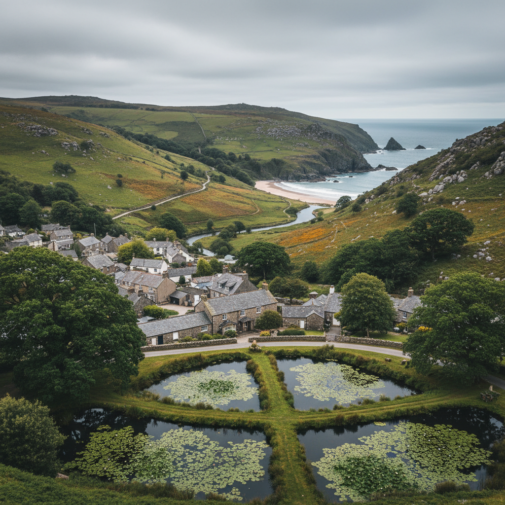
Exmoor · Pembrokeshire-style South West coast feel
Bosherston
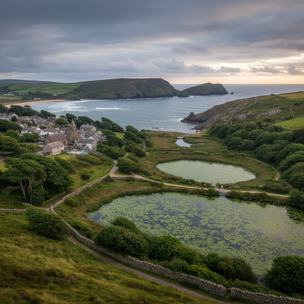
A peaceful village beside lily ponds, wooded paths and dramatic coastal scenery.
About
Bosherston
Bosherston sits at the southern tip of Pembrokeshire, in a landscape that feels distinctly its own: low hedgerows, limestone walls, and a village so small it takes only a few minutes to walk from one end to the other. It is not on the way to anywhere in particular. You come here deliberately, and that deliberate quality shapes everything about a visit.
The land around it has been farmed for centuries, and that fact is visible in the field patterns, the sunken lanes, and the way the village buildings sit close to the earth rather than rising above it. Cottages and a church cluster around a small car park and a pub. There is a post box. There is birdsong. The rhythm of rural life here is not performed for visitors but simply continues around them, as it has for generations.
What draws people to Bosherston, though, is the lily ponds: a network of flooded limestone valleys that stretch west and south of the village, managed as a National Nature Reserve and internationally significant for their wildlife. These are not ornamental lakes but working wetland habitats, dense with aquatic plants and home to otters, kingfishers, and breeding birds that most visitors never see on a first trip.
Beyond the ponds, a short walk through dunes or along the cliff path brings you to Broad Haven South and Stack Rocks, where the coastline opens out into something quite different: vertical limestone cliffs, sea pinks in spring, and Atlantic light that shifts constantly. The village is the quiet starting point for all of it.
Character
The feel of Bosherston
There is something in Bosherston that resists being described as picturesque, even though it plainly is. The church of St Michael, thought to date from the thirteenth century, stands on a low rise at the edge of the village with the composed stillness of a building that has simply always been there. The St Govans Inn opposite is unpretentious in the way that genuinely local pubs tend to be: there are walkers, yes, but also people who have stopped in because it is Tuesday and this is what Tuesday looks like here.
The quietness of Bosherston is not the manicured quietness of a village that has been tidied up for tourism. It is something more structural: the result of its position at the end of a road, away from through traffic, contained by the military ranges to the west and the sea to the south. Sound here tends to be specific and close. A gate latching. Rooks in the churchyard elms. The occasional tractor on the lane. What is absent is the ambient noise of movement that most places carry without noticing it.
This is a village that gives the impression of not needing your approval. It does not solicit attention. Arrive in the right frame of mind and that quality becomes, over a few hours, genuinely restorative.
Map & Getting Here
Getting to Bosherston
What to expect
A natural way to spend time here
The car park at the village edge is where most visits begin, and from there the path network opens in two main directions: down through the woodland fringe to the ponds, or south along the lane towards the coast path junction. Neither route starts dramatically. Both require a patient first fifteen minutes before the landscape begins to reveal itself properly.
At the ponds in summer, the surface is almost entirely covered with white water lily flowers from mid-June onwards. The smell is faint but recognisable: something between pond water and green vegetation, clean rather than stagnant. Dragonflies hold position above the lily pads, then vanish. If you stand at the wooden bridge over the central arm and wait rather than move on, you will almost certainly see more than the group ahead of you, who kept walking.
The place rewards a particular kind of visit: one without a fixed endpoint. Those who arrive with a list of things to accomplish tend to miss the details. Those who leave time to double back along a different bank, or to sit on the embankment and watch the water for a while, tend to leave with a more accurate sense of what this landscape actually contains.
What makes it stand out
What makes Bosherston special
Most villages with a scenic draw have become, to varying degrees, servants of it. Bosherston has not entirely surrendered to that process. The ponds are extraordinary and widely known, but the village itself has not reorganised around visitor convenience. There is no gift shop, no tearoom with bunting, no map board with numbered stops. This is either a frustration or a relief, depending entirely on what you were hoping for.
What makes the place genuinely particular is the convergence of landscape types within walking distance of a single street. Within forty minutes of leaving the village on foot, you can move from the mirror-flat surface of the eastern lily pond arm, through a medieval fishpond embankment, across dune grassland, and onto a beach backed by seventy-foot limestone cliffs. That transition, from enclosed wetland to open coast, is not duplicated elsewhere in South Wales in quite this way. Each landscape type is also ecologically distinct, which means that attentive visitors who walk the full circuit will see a genuinely different range of species at each stage.
Don't miss
Things to see and do
Walk the full circuit of the lily pond arms rather than the out-and-back route most visitors take, particularly the western arm, which is quieter and less frequently described.
Stand at the wooden footbridge over the central pond in mid-morning and wait for the kingfisher that uses this stretch regularly in summer.
Follow the path south through the dunes to Broad Haven South at low tide, when the beach is long and the limestone stacks at the far end are accessible on foot.
Look at the church of St Michael closely: the proportions and the stonework are worth a few minutes of attention even if historic buildings are not usually your focus.
Walk the cliff path west from Broad Haven South towards St Govans Chapel, tucked into a fissure in the limestone at the base of the cliffs.
At Stack Rocks, watch the guillemot and razorbill colonies from the clifftop path in late spring before they disperse offshore.
Return to the village via the northern pond arm at dusk in late summer, when the light sits low across the water and the wildfowl begin to move.
Walks from here
Getting out from Bosherston
The most complete walk from Bosherston takes in the lily ponds and the coast in a single circuit of around four to five miles. From the car park, take the path down to the eastern arm of the ponds and follow the southern bank to the dunes and Broad Haven South beach. From the beach, the coast path runs west along the clifftops to St Govans Head and Stack Rocks, where the path turns north and eventually loops back inland towards the village. The full loop takes most walkers around two to two and a half hours at an unhurried pace, with additional time if the beach or cliff sections invite lingering.
For a shorter visit focused entirely on the ponds, the figure-of-eight path around all three arms of the lily pond system can be walked in around an hour. This route stays low, shaded by alder and oak along some sections, and is well-suited to anyone who prefers a woodland-and-water walk over exposed coastal terrain. Note that the military ranges west of Stack Rocks are closed on some days, which affects access to parts of the cliff path
the Castlemartin Range website posts current access information and is worth checking before planning a longer coastal route.
Good to know
Before you go
The car park at Bosherston is managed by the National Trust and fills quickly on summer weekends, particularly when the lily flowers are at their peak between mid-June and mid-July. Arriving before ten in the morning makes a significant difference. The ponds path can be muddy in wet weather even in summer, and the wooden bridges over the inlet channels are occasionally slippery
footwear with grip is worthwhile rather than optional. Dogs are welcome on leads along the pond paths but should be kept under close control given the ground-nesting birds in the surrounding grassland.
There is no café in the village, though the St Govans Inn serves food. Bringing water and something to eat is sensible if you are planning a full pond-and-coast circuit, since there is nothing available between the village and the beach.
Across the seasons: The peak of the lily flower season, typically mid-June to mid-July, is when Bosherston attracts its largest numbers of visitors. The ponds are genuinely worth seeing at this point, but so is arriving early in the morning when the light is low, the car park is empty, and the surface of the water has not yet been disturbed by the day's foot traffic. Later in summer the flowers begin to thin, but the dragonfly activity intensifies through August. Autumn changes the pond landscape considerably: the lilies die back, the water opens up, and the village begins to belong to itself again. October brings wildfowl to the ponds in numbers that summer visitors rarely see, including tufted duck and coot in loose aggregations across the central arm. The coastal path at this time of year is often at its most dramatic, with Atlantic swells and low, travelling light on the limestone cliffs. Winter visits are quiet to the point of near-solitude. The ponds are clear of vegetation and the bird life is easier to observe without the distraction of the lily surface. The village in January or February has a self-contained quality that makes the rural character of the place more legible: smoke from chimneys, the pub lit from inside, the lane empty for long stretches at a time.
Practical info
Practical info
There is a small National Trust car park at Bosherston, which serves both the village and the lily ponds walks. It fills quickly during summer weekends and bank holidays, and space is genuinely limited. Arriving before 10am gives a reasonable chance of finding a spot. There is no overflow provision nearby, so later arrivals may find themselves turning back.
The St Govan's Inn in the village provides food and drink, and is the primary facility for visitors. There are public toilets near the car park, though these may have restricted opening hours outside peak season. There is no visitor centre, no café independent of the pub, and no shops. Come provisioned if you plan a longer day.
The paths around the lily ponds are well-maintained boardwalks and compacted tracks, and are manageable for most visitors in ordinary walking shoes during dry conditions. After rain, the boardwalk sections can become slippery and the field paths leading toward the coast turn muddy underfoot. The coastal section beyond the ponds involves steeper gradients and rougher terrain, and stout footwear is advisable if you intend to continue that far. The village itself is level and presents no difficulty.
varies
Explore nearby
Places nearby
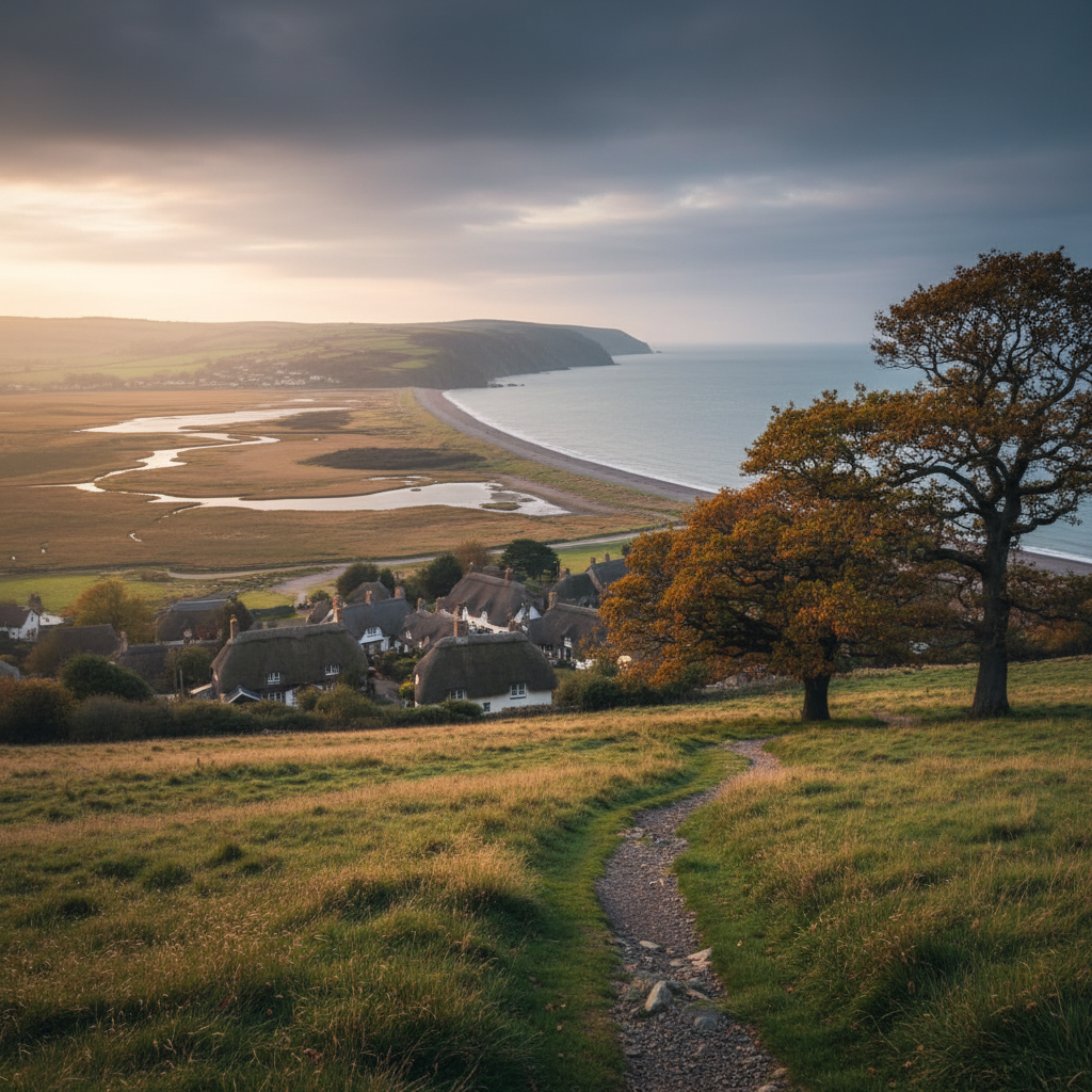
Bossington
Bossington offers a softer Exmoor coastal stop, with village character, marshland, beach and good walking links.
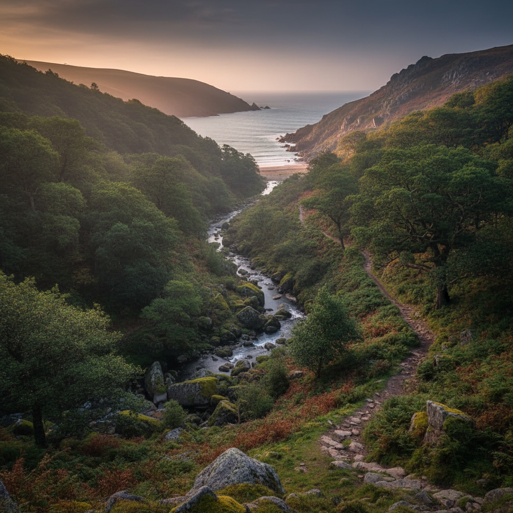
Heddon Valley
Heddon Valley is one of Exmoor’s best coast-and-combe places, combining woodland, river and sea-edge walking.
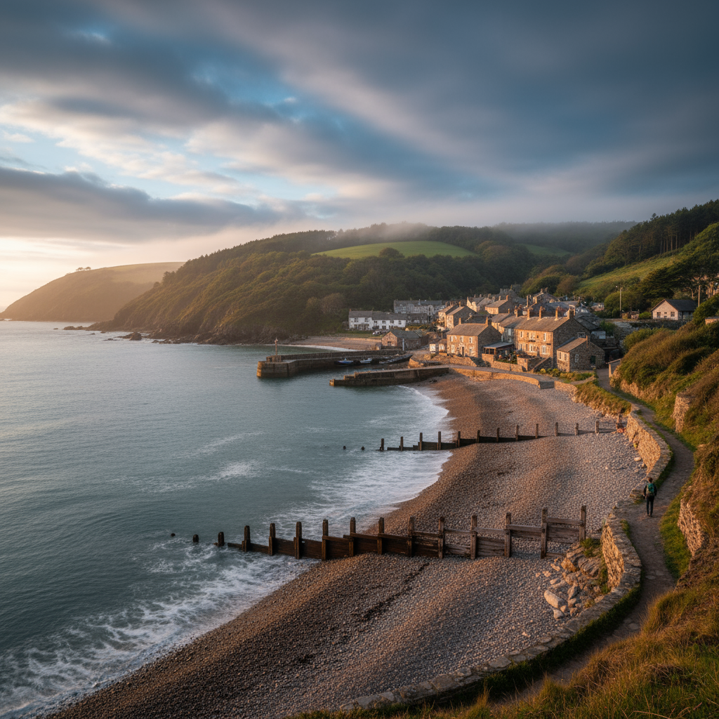
Porlock Weir
Porlock Weir adds harbour character, coastal walking and one of Exmoor’s most atmospheric sea-edge stops.
Bosherston
Bosherston combines calm inland water landscapes with access to striking cliffs and beaches.
Join the 3moors Community for path conditions & local tips.
JoinWhy this place matters
Bosherston — in its own right
Places that hold together as communities rather than reorganising entirely around the visitor tend to have a particular quality: you sense that life would continue here more or less unchanged whether or not you arrived. Bosherston is one of those places. The people who live along its lane and use its pub are not incidental to the landscape; they are part of what keeps it from tipping into the managed quietness of a heritage site. That quality of community persistence, unshowy and easy to overlook, is perhaps what the place leaves you with most lastingly. Not the lily flowers, which are remarkable, and not the coast path views, which are genuinely striking, but the sense that this small cluster of buildings and the landscape around it have been in a long, mostly unremarkable conversation for a very long time, and are not about to stop.