
Exmoor · Central Exmoor
Simonsbath
A remote-feeling settlement deep within Exmoor’s open upland landscape.
About
Simonsbath
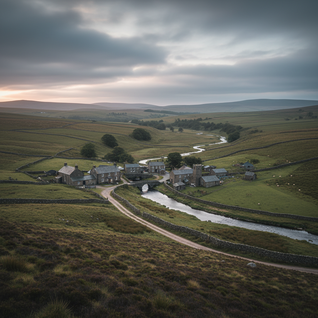
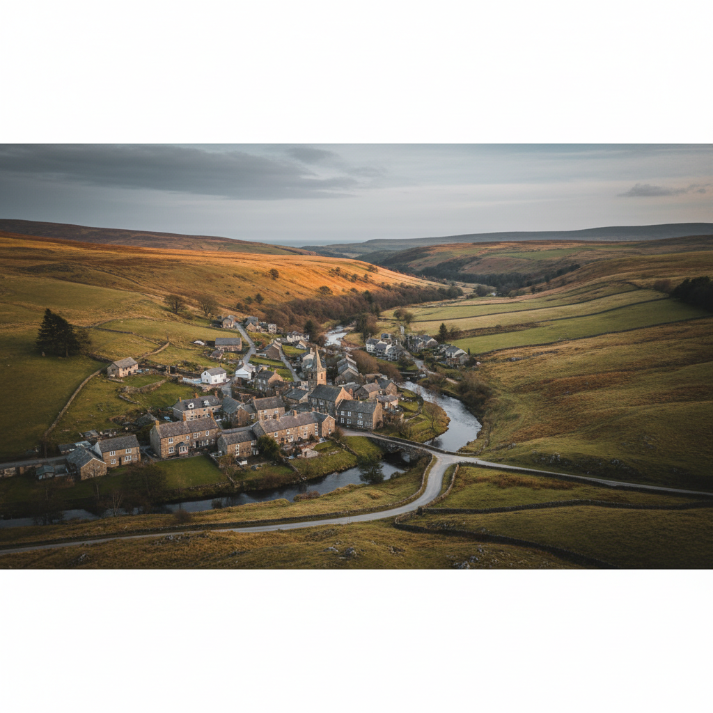
Simonsbath sits in the upper valley of the River Barle, cradled by steep wooded hillsides that give way, almost immediately beyond the hamlet's edge, to the open moorland plateau. It is, by most measures, an unremarkable cluster of buildings: a handful of houses, an inn, a church, and a sawmill complex that has stood in various forms for generations. What makes it notable is precisely its position. At roughly 1,200 feet above sea level and several miles from the nearest significant settlement, Simonsbath is about as far into central Exmoor as you can get by road without losing the road entirely.
The landscape here is on a different scale from the coastal fringes of the moor. The valleys are deeper, the silences longer, the horizons uncluttered by development. The Barle, still young this close to its source on the high plateau, moves through the valley floor with a steady, purposeful sound. The wooded slopes either side are birch, oak, and rowan, the canopy thin enough to let in a good deal of sky. Walk five minutes in any direction and the trees give out and the moorland opens up: grass and rush and heather, with the wind finding you as it finds everything up here.
Simonsbath is inseparable from the history of the Royal Forest of Exmoor. The hamlet as it stands owes its existence largely to John Knight, who purchased the former royal forest in the early nineteenth century and set about improving it, with mixed results, as a farming estate. The walled enclosures, the lodge at the centre of the hamlet, and the grid of moorland roads radiating outward are all legacies of that period. Knight's ambition was to transform an unmanaged upland into productive farmland. What he left behind instead was a kind of ordered emptiness: fields that never quite flourished, roads that seem to lead further into solitude rather than out of it.
People come here for the walking, and for something harder to name: the sensation of being well inside a landscape rather than skirting its edges. Simonsbath does not reward a quick stop. It asks for a longer engagement, a willingness to set out on foot and let the ground tell you where things are.
Character
The feel of Simonsbath
The hamlet has the look of somewhere that settled into its current form gradually and without great ambition. The Exmoor Forest Hotel, a solid stone building, anchors one end of the small centre. The church of St Luke, built in the mid-nineteenth century as part of the Knight improvements, stands in a position that feels slightly too exposed, as if the shelter of the valley hadn't quite been thought through. A few estate cottages, a sawmill, a scattering of farm buildings: the whole thing could be walked end to end in four minutes. There is no shop, no visitor centre, no tearoom separate from the hotel. Simonsbath makes no great effort to receive you.
What gives it character is the continuity of purpose. The people who live and work here are connected to farming and the land in a way that is still functional rather than merely historical. The Barle valley farms carry on as they always have, with stock moving across the moorland roads and gates that exist for a practical reason rather than a scenic one. There is a particular quality to hamlets whose identity has not shifted toward tourism, and Simonsbath is one of them. It remains oriented toward the moor, not toward the visitor. That is not unwelcoming. It is simply honest about what the place is for.
The sense of local character here is also bound up with a certain resilience. This is not an easy landscape to inhabit. The winters are long, the access roads can be treacherous in ice and snow, and the nearest market town is a significant drive. The people who choose to remain do so with a clear-eyed understanding of the trade-off. That quality of deliberate inhabitation gives Simonsbath a gravity that softer, more accessible settlements rarely have.
First-hand visit
Keith's Take
Something about the river at that level, running fast and cold beneath the bridge, made it clear very quickly that this was not the kind of place you passed through on the way to somewhere else.
The sound of the Barle reached me before the hamlet itself came into view: a high, continuous note from the shallows below the bridge, the kind of sound that makes you adjust your pace without quite deciding to. Moving along the road above the valley, the first thing that resolved was the scale. Not large. Not picturesque in any arranged way. A stone hotel, a modest church on a slight rise, a row of cottages, a gate at the far end. The Knight estate imposed its geometry on this valley in the 1820s, and the geometry is still here, still faintly legible in the enclosure walls and the formal line of the approach road, even if the ambition behind it never quite succeeded in making the landscape comply.
What emerged as I moved further up the valley and onto the open ground above the hamlet was a different kind of understanding. The enclosure walls end with a particular abruptness. One side: improved pasture, stone-edged, controlled. The other side: the open moorland plateau, unmanaged and vast, carrying on without reference to whatever happened in the valley below. That boundary is not dramatic to look at. It is a wall, then open ground. But the shift it marks is worth sitting with. The Knight project tried to contain this landscape and the landscape declined to be contained. The evidence is the moor itself, still here, still unconvinced.
By the time the Barle curved south and the roofless mine building at Wheal Eliza appeared on the far bank, I had been walking for perhaps forty minutes without seeing another person. A buzzard had gone over twice on the same thermal, suggesting either idle efficiency or mild curiosity. The sky had been doing what Exmoor skies do in unsettled weather: shifting between overcast and something almost luminous, the light changing the colour of the grass with each movement of the cloud. There are places where you feel the specific weight of a landscape and Simonsbath is one of them. Not oppressive. Just present.
Keith's Take — a first-hand account from the 3moors team
Map & Getting Here
Getting to Simonsbath
What to expect
A natural way to spend time here
The hamlet resolves itself quickly as you move through it. The main road passes the hotel, crosses the Barle on a narrow bridge, and then begins to climb out toward the open moor. There is almost no reason to linger in the centre itself: the action, such as it is, happens in the landscape around it. Within ten minutes on foot you are on ground that feels genuinely remote, with the village invisible below and the moorland plateau stretching in every direction.
Down at river level, the sound of the Barle is constant and absorbing. It moves fast over a stony bed here, with a high, bright note that carries some distance upstream. In the wooded sections beside the water there is the smell of damp stone and leaf litter, and the particular green darkness of a West Country river corridor in summer. Dippers are resident on this stretch. So are grey wagtails, precise and restless at the water's edge. In the upper valley sections away from the trees, the wind is almost always audible.
The place rewards a patient, attentive approach above almost all else. Come prepared to walk rather than browse. Bring waterproofs and appropriate footwear: the moorland tracks drain poorly after rain, and even in dry periods the valley-bottom paths hold moisture. The hotel provides food and accommodation, but it is worth checking opening times and availability before relying on it as a stop. Simonsbath is not a place you drift through on a whim.
What makes it stand out
What makes Simonsbath special
Most Exmoor villages have at least one eye turned toward the visitor economy: the cream tea, the gift, the view marketed back at you from a postcard stand. Simonsbath has none of that, not because it is inhospitable but because it simply does not have the critical mass to support it. The result is a settlement that feels genuinely indifferent to your presence, in the most neutral and useful sense. You arrive, and the place continues as it was.
What distinguishes Simonsbath from other remote moorland hamlets on Exmoor is the particular combination of its elevation, its river, and its Knight estate heritage. Together these three things give the place an identity that is neither purely pastoral nor purely upland. The walled Knight enclosures push right up to the edge of open moor. The Barle arrives at the valley floor with the energy of a high moorland river that has not yet settled into middle age. And the estate buildings, solidly Victorian and slightly too formal for their setting, create an odd, interesting friction with the rawness of the landscape around them. That tension, between the imposed order of the nineteenth-century improvement and the elemental moorland that absorbed it without being changed by it, is particular to this place.
Don't miss
Things to see and do
Follow the Barle upstream from the bridge at the hamlet centre, keeping to the valley floor where the path runs close to the water.
Watch for dippers working the faster, shallower sections of the river, bobbing on mid-stream stones before dropping under the surface.
Cross onto the open moor above the Knight enclosures and walk south toward Cow Castle, the Iron Age hillfort that rises above the valley with unexpected clarity.
Find the Wheal Eliza mine remains on the eastern bank of the Barle: the roofless engine house sits in a position that says a great deal about how hard this landscape was to extract anything from.
Walk the Barle Valley route northward as far as the landscape opens out onto Exe Plain, where the ground flattens and the sense of exposure becomes complete.
Look at the church of St Luke closely: the Victorian confidence of the interior sits in sharp contrast to the emptiness outside the door.
In the evening, when the day-walkers have gone, stand on the road above the hamlet and listen for nothing in particular.
Walks from here
Getting out from Simonsbath
The Barle Valley walk is the obvious and best reason to be in Simonsbath. The river can be followed south through Flexbarrow toward Withypool, a distance of roughly four miles with a return possible on the higher ground of the western valley side. The terrain is varied: woodland, open riverside pasture, and sections of rougher moorland above the flood plain. The path is well-established but uneven in places and muddy after rain.
Northward from Simonsbath, the ground opens up onto Exe Plain and the watershed country around the head of the River Exe. This is less walked and more exposed than the river routes. The going is rougher and the landmarks fewer. It suits those comfortable with map and compass work. The Two Moors Way passes through Simonsbath on its route between Exmoor and Dartmoor, which provides a reliable navigational thread through this section of the moor for those following it in either direction.
For a shorter outing, the ground immediately above the hamlet to the east gives access to Cow Castle and a circuit back via the Barle that takes two to three hours at a measured pace. The ascent from the valley floor is gradual and the views from the fort earthworks are worth the modest climb.
Good to know
Before you go
Mobile phone signal at Simonsbath is unreliable and in places non-existent. Download maps offline before you travel. The moorland tracks shown on OS maps are not always well signed on the ground, and some paths marked as public rights of way cross genuinely rough terrain. A physical map and the ability to read it are not optional on the higher ground here.
The road into Simonsbath from Exford or Lynton can be challenging in ice. In hard winters, access has been cut for days at a time. If you are staying locally and the forecast is severe, check road conditions before committing to a departure. Parking at the hamlet is limited and the road is narrow: arrive early in peak summer months if you are day-visiting, or consider a midweek trip when the car park at the hotel is less pressured.
Across the seasons: The seasonal rhythm at Simonsbath is more pronounced than at settlements on the moor's edge, because the elevation and the inland position amplify every shift in the weather. Spring arrives measurably later here than on the lower ground: the trees along the Barle come into leaf in May rather than April, and the grass on the high plateau above can still be winter-pale into June. But when the valley does open up it does so with a particular completeness, the birdsong loud and the river running clear after the last of the winter spates. Late October is the moment most worth seeking out if solitude and colour are what you are after. The bracken on the moorland slopes turns a deep, reddish amber from mid-month, and the birch canopy along the Barle follows it shortly after with its own yellow. The contrast between the dark evergreen of any remaining conifers and the dying bracken is specific to this type of upland and it is striking without being theatrical. Visitor numbers have thinned by this point in the season. Winter here is genuine. The hamlet sees few visitors between November and March, the hotel may operate on reduced hours, and the high moorland routes above the valley can be dangerous in snow or freezing fog. For those who do come in midwinter, the landscape has a stripped-back quality that is unlike anything the warmer months offer. The Knight enclosure walls stand out clearly against bare ground, and the sounds of the moor carry further in cold, still air. It asks more of you than any other season, and it gives back accordingly.
Practical info
Practical info
Parking at Simonsbath is limited and informal. A small pull-in area exists near the Exmoor Forest Hotel, but spaces are few and there is no dedicated visitor car park in the hamlet itself. Arriving early, particularly at weekends and during summer, is advisable. Be considerate of the small resident community when choosing where to leave a vehicle.
The Exmoor Forest Inn (formerly the Exmoor Forest Hotel) provides food and drink, and is likely the only reliable facility in the hamlet. There is no village shop, no public toilets, and no visitor centre. Those planning longer days on the hill should arrive self-sufficient, with food, water, and navigation tools already in hand.
Simonsbath sits within a river valley, but most walking routes leave the settlement quickly and climb onto exposed upland ground. The terrain is a mix of grass moorland, boggy hollows, and river-cut combes, and wet weather makes many paths slippery and waterlogged. Sturdy waterproof footwear is genuinely necessary here, not optional. Gradients are moderate but sustained, and the open ridges above the valley offer little shelter in poor conditions.
varies
Explore nearby
Places nearby
Bossington
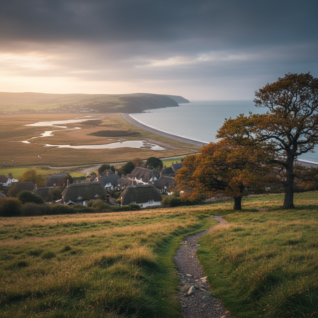
Bossington offers a softer Exmoor coastal stop, with village character, marshland, beach and good walking links.
Heddon Valley
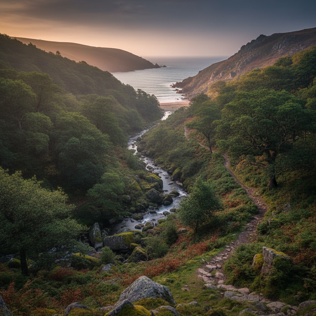
Heddon Valley is one of Exmoor’s best coast-and-combe places, combining woodland, river and sea-edge walking.
Porlock Weir
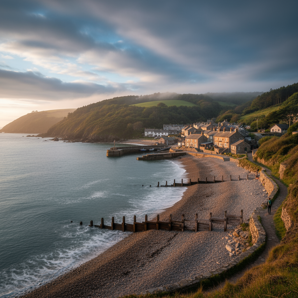
Porlock Weir adds harbour character, coastal walking and one of Exmoor’s most atmospheric sea-edge stops.
Exford
Exford combines village character with direct access to central Exmoor walking.
Join the 3moors Community for path conditions & local tips.
JoinWhy this place matters
Simonsbath — in its own right
Simonsbath leaves you with an awareness of how much of Exmoor remains unconcerned with being visited. There are places on the moor that have accommodated tourism elegantly and on their own terms. This is not quite one of them. It is a working place in a working landscape, shaped by agricultural ambition, geological accident, and the steady indifference of high ground to human plans. What stays with you is the rhythm of the place across the year: the way the valley contracts in winter, the way it opens again with the new growth along the Barle, the way the farming calendar gives the hamlet its structure rather than the tourist season. There are not many settlements in the south-west of England where you can still say that with confidence. Simonsbath is one of them, and that is worth a great deal.