
Quick facts
Why this place matters
Grimspound gives a rare, almost intact window into ordinary Bronze Age life on Dartmoor, houses, boundaries, landscape and survival still readable nearly 3,500 years later.
Long before written history reached Dartmoor, people built a settlement high on the open moor. Its walls still stand.
What it is
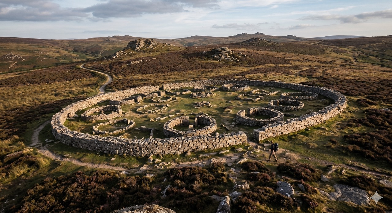
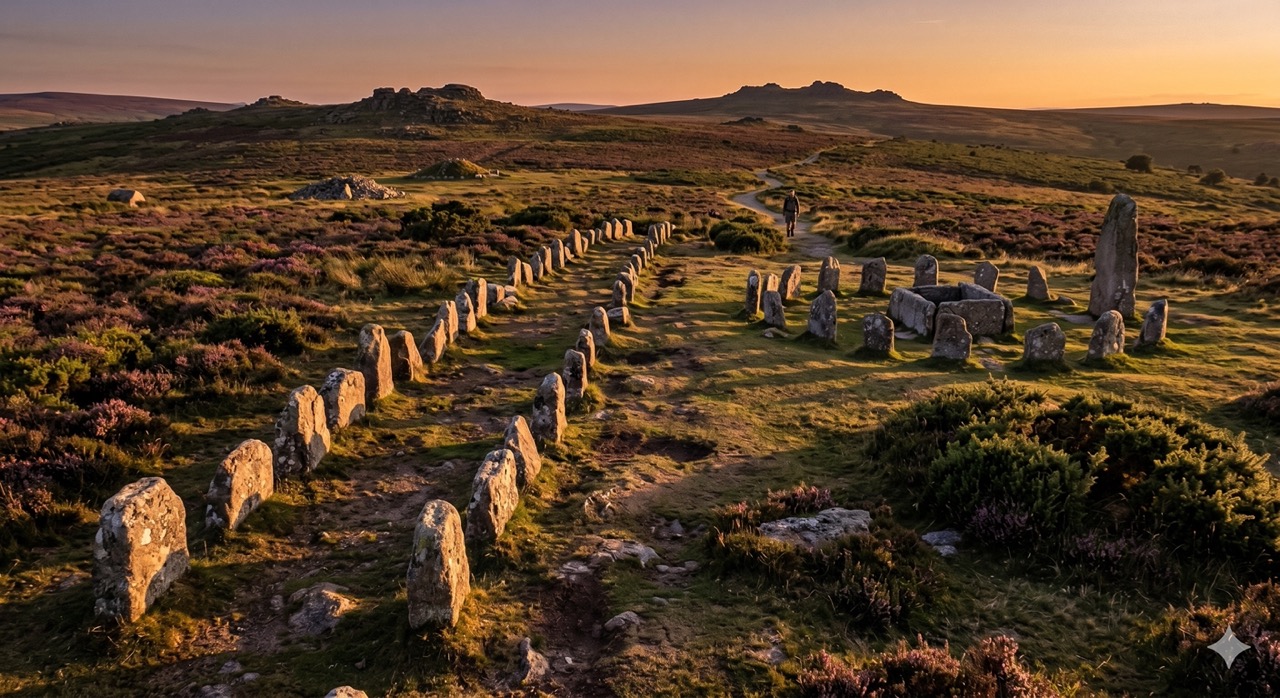
Grimspound is a Bronze Age enclosed settlement, with surviving hut circles inside a large stone boundary. It is one of Dartmoor’s best-preserved prehistoric sites.
Why it mattered
It mattered because it gave a farming community shelter, enclosure and a base for surviving and working in a demanding upland landscape.
What you can see
Outer enclosure wall Hut circles Main entrance gap Internal stone divisions Nearby prehistoric field systems
Few prehistoric places feel this immediate.
What happened here
Grimspound gives a rare, almost intact window into ordinary Bronze Age life on Dartmoor — houses, boundaries, landscape and survival still readable nearly 3,500 years later.
Likely built during the later Bronze Age, Grimspound was once part of a much wider Dartmoor farming landscape.
Its people were not isolated primitives, but organised communities managing livestock, field systems and seasonal survival.
The stone enclosure may have protected people, animals, or both.
Eventually the settlement was abandoned, but its form survived in the granite.
Centuries later, antiquarians speculated wildly about its purpose.
Archaeology brought a more grounded story: a real settlement, real people, real lives.
Key dates
c. 1300–900 BC
Settlement likely occupied
Bronze Age
Part of wider Dartmoor farming system
1890s
Major excavation by Baring-Gould and Burnard
20th century onwards
Modern archaeology refines interpretation
Standing here now
The striking thing about Grimspound is how legible it remains. This does not feel like scattered ruins. It still feels organised. You can read streets, homes, edges and enclosure. Wind moves across the same ground its builders knew. Few prehistoric places feel this immediate.
What to look for
- 1Outer stone enclosure, surviving in places to nearly chest height
- 2Twenty-four hut circles inside the settlement
- 3Main southern entrance gap
- 4Internal divisions and possible livestock areas
- 5Hut circle doorways
- 6Wall thickness differences
- 7Nearby reaves (ancient field boundaries)
- 8Relationship with Hameldown and surrounding tors
Landscape & wider significance
Grimspound was not built randomly. Its position offered open visibility, nearby water, grazing land, granite for construction, and natural shelter from surrounding uplands. Landscape was part of the settlement's logic.
Myths & folklore
Victorians once imagined Grimspound as a druid temple or ceremonial enclosure. That mystery still lingers. But the real story, ordinary people making life on a hard upland, may be more powerful than myth.
Visiting today
Terrain
Open moorland, rough ground
Best visited early morning for atmosphere, or late afternoon for low light. Dry conditions after wet weather are ideal. Combine with Hookney Tor or Hameldown. Allow time to sit. This is a place to read slowly.
Good to know
💡 Did you know?
🎯 Try this when you visit
🤔 Think about this
Map & Directions



Related history nearby
Good to know
Dogs
Welcome
Families
Suitable for families
Terrain
Open moorland, rough ground
Join the 3moors Community for path conditions & local tips.
JoinNearby places
Quick facts
OS Grid Ref
SX 700 809